Isometric map of Seoul — FAQ
Is there an isometric map of all of Seoul?
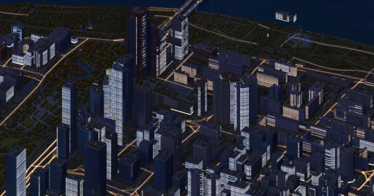
Yes. HypeSeoul (hypeseoul.xyz) is an isometric, hand-painted-style map of the whole of Seoul, about 603 km². It runs in the browser; drag and zoom down to street level.
Is there something like isometric.nyc for Seoul?
HypeSeoul was inspired by Andy Coenen's isometric.nyc and does the same idea for Seoul, built independently: no code or training data from isometric.nyc was used.
How was the AI-painted Seoul map made?
Seoul was built in 3D with three.js from OpenStreetMap, Overture Maps, the Korean building register (floor counts) and terrain data. An open image model (FLUX.2 klein 4B, LoRA) fine-tuned on 33 render-to-painting pairs then repainted all 6,394 tiles. Landmarks and Han River bridges were repainted one by one.
Can I see Seoul subway trains in real time on a map?
Yes. Lines 1, 2, 3 and the Gyeongui–Jungang line move by the Seoul city government's real-time train position data, refreshed about every 10 minutes; between updates positions are estimated from direction and speed. Trains in tunnels are not drawn.
Which Seoul landmarks are on the map?
Gyeongbokgung, Changdeokgung, Changgyeonggung, Deoksugung and Jongmyo; Sungnyemun and Heunginjimun; Seoul City Hall; the National Assembly; N Seoul Tower; 63 Building; IFC Seoul; Parc1; LG Twin Towers; Lotte World (Adventure and Magic Island); Dongdaemun Design Plaza (DDP); Jamsil Olympic Stadium; Seoul World Cup Stadium; Gocheok Sky Dome; COEX and the Trade Tower; Bongeunsa; the National Museum of Korea; the War Memorial; Seoul Arts Center; Sejong Center; Seoul Square; Culture Station Seoul 284; the Amorepacific HQ; Leeum; Seoul Botanic Park; Oil Tank Culture Park; Seongsu-dong headquarters (Musinsa, Gentle Monster Haus Nowhere and others); the Han River bridges and parks are painted individually to match their real shapes. Every other building is drawn at its real position and height.
Does it change between day and night?
Day and night follow Seoul time and windows light up at night. Cars, buses, Han River boats, people and the live subway move across the map.
Is it free, and does it work on mobile?
It is free with no sign-up and opens in phone and desktop browsers. It uses WebGL, so very old devices may be slow.
Where does the map data come from?
Map data © OpenStreetMap contributors (ODbL), Overture Maps, the Korean building register (MOLIT), Seoul Open Data (real-time train positions) and AWS Terrain Tiles.
How can I get in touch or list a place?
Use LIST YOUR PLACE in the map, or email gptsnoo@gmail.com.